Green Infrastructure Mapping Pilot Project
Green Infrastructure Mapping Pilot Project: a citizen science approach to creating a vision for Edinburgh’s green spaces
The Parks Green Infrastructure Mapping Project is part of the Thriving Green Spaces programme of work. This pilot mapped parks to measure their quality considering biodiversity and health benefits, while also providing opportunities for citizens to get involved.
There is mounting scientific evidence that human contact with green and blue spaces, or natural places, can have significant health and wellbeing benefits. Visiting parks and other green (and blue!) spaces can lead to increased physical activity as well as feelings of relaxation, ability to concentrate and to sleep, for example. Covid-19 saw an enormous rise in people using our parks.
These spaces can also create a sense of valued place and community. Natural green and blue spaces also assist in carbon sequestration – by trees and plants absorbing CO2 from the air, improving air quality – again, by trees and plants absorbing pollutants from the air, and by dampening the urban heat island effect.
Trees also provide shade which keeps us cool in summer, as well as contributing to flood prevention, all of which deliver human health benefits making life in the city much more pleasant.
Maintaining the diversity of plants and animals in these spaces makes them more resilient. We also want to conserve biodiversity in urban areas as part of conservation efforts, to ensure the continued survival of local species that may struggle to survive if we fail to provide the right habitats in parks, for instance.
Green (and blue) infrastructure mapping – who, what and why in more detail!
The Parks Green Infrastructure Mapping Project is led by the University of Edinburgh, and includes EDINA digital mapping experts, the Department for Social Responsibility and Sustainability (SRS) and the School of Geosciences.
The pilot has developed and tested a green infrastructure mapping application in selected park sites in Edinburgh. The application is able to provide monitoring of the location and quality of greenspaces in the city considering biodiversity and ecosystem services. It provides an easy to use map visualisation of selected areas.
Each type of green space in the pilot parks has been given a score associated with its quality, or biodiversity and ecosystems value. These scores are then added up and divided by the area of the park to provide a Green Infrastructure (GI) factor or score. The scoring system is based on the Natural Capital Standard (NCS) for Green Infrastructure (GI) developed by the Scottish Wildlife Trust (SWT).
The application will equally have value as a tool to be used by the public to learn more about parks in Edinburgh through visualisations and amenity information provided by the app, and by Council parks staff in management and maintenance of green (and blue) spaces.
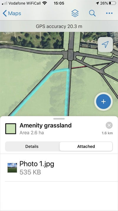
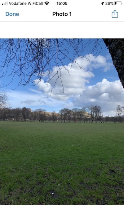
GI mapping of the Meadows using the app
The following parks were chosen for mapping in the pilot:
- Meadows and Bruntsfield Links
- Saughton Park
- Cramond Foreshore
- Burdiehouse Burn Valley Park
- George Square
Community engagement – citizen science and understanding your views on green spaces
The development of the GI Mapping tool was only possible through the valuable work of volunteers undertaking citizen science to populate it and test its usability. It was an exciting opportunity for us to engage with community members and for community members to meet new people and gain new experience. Volunteers received training in use of the tool, became familiar with how types of green spaces are being valued for biodiversity and health and wellbeing, and they had input throughout the tool development process.
We were also keen to capture volunteers’ emotional/value responses to different types of green spaces, so how they affect feelings of wellbeing. Responses could then be compared against the scorings determined by the GI tool. This study fed into further development of the tool.
Huge thanks to everyone who participated, including students on the undergraduate Nature, Greenspace and Health course at the University of Edinburgh and volunteer students and community group members. The mapping exercises involved using the app to gather data on types of green spaces in the parks and interviews with participants about their responses to the green spaces they were experiencing as they volunteered.
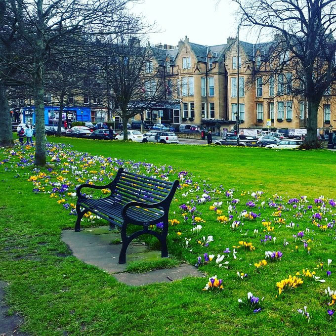
Bruntsfield Links, part of phase one of the pilot
The second phase of activity included a user needs workshop, where we asked community members to review the functionality of the tool and what they would like to see developed for public use. We also conducted a workshop with Council Parks staff to understand their needs for their version of the app.
As part of phase three, volunteers were trained in use of the app and then will go out to the selected park sites to collect data on types of green spaces to populate the tool, which adds the detail in the map visualisation. Volunteers can also participate in our study to gather experiences and perceptions of different types of green spaces during this phase. The pilot ends with a project results workshop, where all volunteers are invited to participate and give final feedback.
Ultimately, the Parks Green Infrastructure Mapping app will allow the Council to measure the quality of parks and improve upon them, accounting for biodiversity and all those natural services that contribute to health and wellbeing, with on-going community engagement.
We engaged with volunteers through a Facebook group, Edinburgh Green Spaces Mapping which is a good way to encourage communication across volunteers and share info so please do drop into see what's happening.